
Coastal Land Use Methodologies Under Pressure

This resource has been reviewed by SubjectToClimate's climate scientists and verified for scientific accuracy and up-to-date information. Learn about our review process →
Provided by: Springer Link|Published on: May 17, 2024
Data, Graphs, and MapsScientist Reviewed
1112AP
Scientist Reviewed This resource has been reviewed by SubjectToClimate's climate scientists and verified for scientific accuracy and up-to-date information. Learn about our review process →
Synopsis
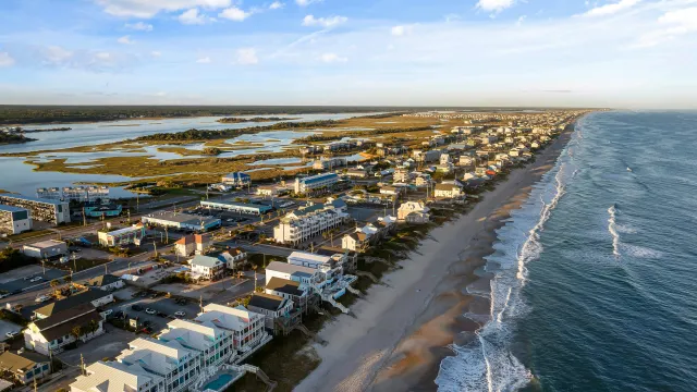
- This scientific report describes research conducted to understand the dynamic interaction between the ocean and land in Connecticut's coastal areas and how this understanding should influence city planning and infrastructure.
- The study looked at four coastal locations in Connecticut: New Haven Harbor, New London's downtown waterfront, New London Ocean Beach, and Jordan Cove in Waterford.
Subjects: Science, Geography
Authors: Tao Wu and Juliana Barrett
Region: North America, USA - Northeast, United States, Connecticut, Coastal CT
Languages: English
Teaching Materials
Positives
- This study's use of charts and figures allows students to anchor their understanding with numbers and data.
- The website includes an index of figures where students can view full-sized versions, making it easy to refer back to as needed.
Additional Prerequisites
- This report is complex, and teachers should ensure that students have experience with reading scientific reports. It may help if students are familiar with the format.
- Students should be familiar with some adaptation strategies that coastal cities implement to reduce climate change impacts, such as green infrastructure, sea walls, permeable ground, and others.
- Some of the links to cited materials do not work.
Differentiation
- Some students may benefit from a printout of the PDF to highlight and annotate as they read.
- Students can use the coordinates of the study's focus locations to practice with GIS mapping tools.
- Language arts students can practice informative writing by creating pieces to explain to city planners what measures they should consider when making their coastal communities more resilient.
- After reading the report, students can discuss why humans better adapt to abrupt changes like floods than to gradual changes like climate change. Students can find examples of adaptation or lack thereof in the face of different environmental shifts.
Because this is a scientific study in a peer-reviewed and accredited academic journal, this resource is recommended for teaching.
Teaching Tips
Standards
Resource Type and Format
Scientist Reviewed
This resource has been reviewed by SubjectToClimate's climate scientists and verified for scientific accuracy and up-to-date information. Our review process ensures that every resource in our library reflects the current state of climate science.
Learn about our review process →